May 1,
2012: Just outside
the shop - tornado!
All text and images Copyright Michael E. Lockwood, all rights reserved.
First, let me say this - your mirrors are fine! The shop and house are fine too.
Yes,
you read it right, I saw a tornado today, the first for me. I did
see a cold-air funnel about 20 years ago northeast of Cincinnati, but
this was very different. Most of the time it was funnel cloud,
but I'm pretty sure it touched down at some point while I was
photographing it. It was no closer than several miles and not
very strong, but certainly it was not expected.
I was talking on
the phone with Rick Singmaster (owner of Starmaster Telescopes) when I
happened to look out the window to see which way some very recently
developed thunderstorms were moving. The storms had popped up
very quickly, and would bring some needed rain to the area.
I
saw a strange, low cloud roughly ten miles to the west of my shop.
It was sunny at the time, and not raining. The cloud looked
quite distinct and low, and it appeared to be changing shape.
While
still on the phone, not thinking much of it, I checked the weather
radar, and it showed a fairly good storm to my west. I clicked on
the "Show Severe" option, which highlights severe weather warnings.
The storm's area on the map lit up with a red color, indicating a
tornado warning!
I looked back out the window, noted the
rotating cloud, and said to Rick - "I need to get off the phone.
I think I see a funnel cloud." I don't think I can share
his reply here. Rick lives in southeast Kansas, so he understands.
For a moment I was
a bit worried, but then I saw that the storm was heading
northeast. So of course I ran (literally) to grab my camera and
telephoto lens, and headed outside.
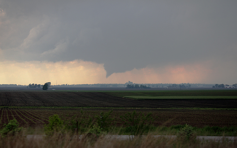
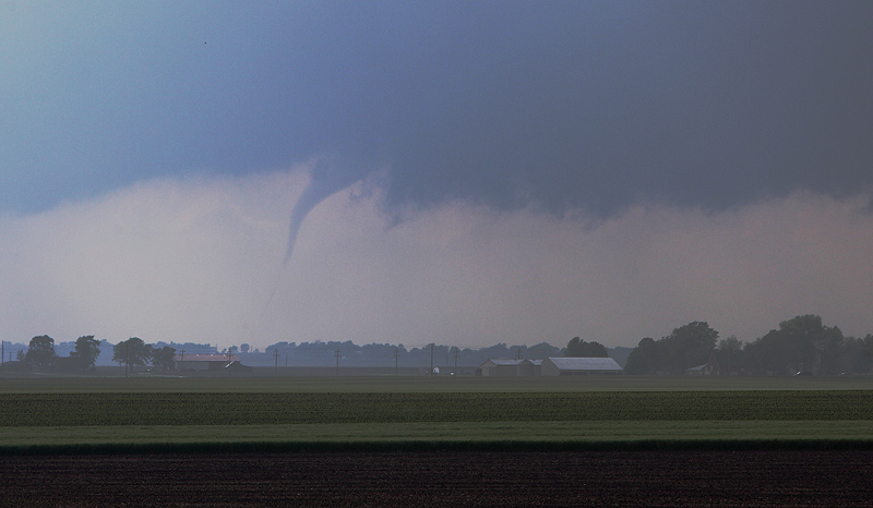
Above
we see the funnel cloud that got my attention, although it is a bit
more funnel-shaped than it was when I first spotted it. The silos
on the horizon are in Tolono, IL.
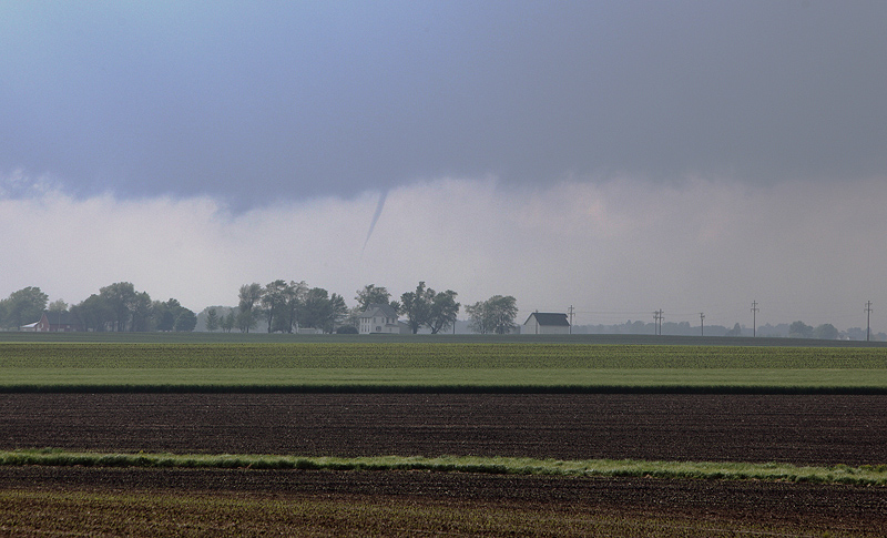
Zooming
in a bit more, the cloud has moved closer, but it is now to the
northwest of me and clearly not heading in my direction. I was
concerned about the town of Philo to my north, Urbana, Sydney, and
Homer, because I thought it might get stronger. I'm not sure it
was on the ground at this point, but other photos from closer to it
show that it likely was.
At
this point the funnel had gotten quite thin, and was moving to the
right within the dark overhanging wall cloud seen in the image above.
It moved, disappeared, and reformed a few times. Then it
disappeared.
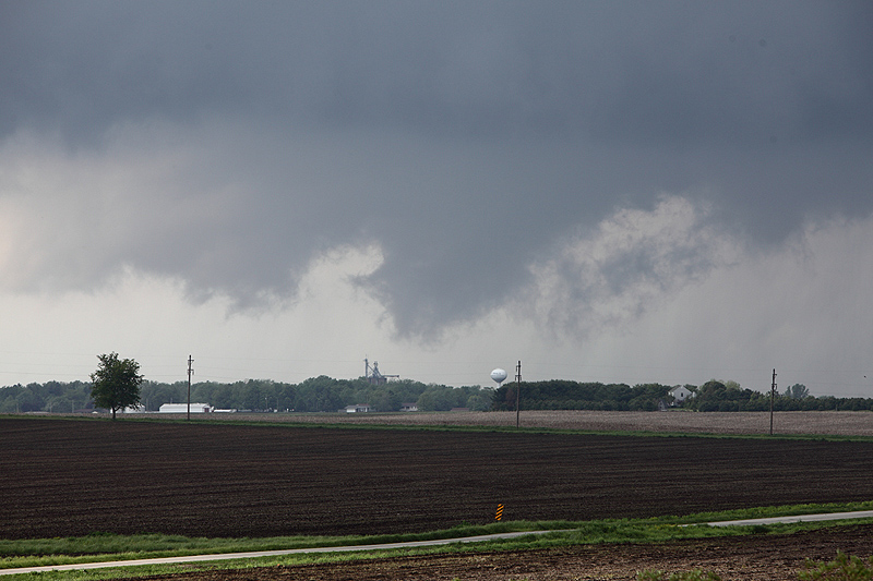
This
cloud was not spinning - it was just low hanging. The water tower
is in Philo, a few miles north of me. The cloud was a bit north
of there I think. The sirens were going off at this time.
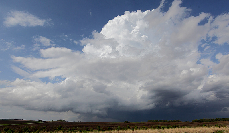
For
this shot, while the funnel was not visible I grabbed a 14mm wide-angle
lens to get a nice shot of the whole storm from the ground up.
The funnel had been appearing just left of center. All of a
sudden I saw some redevelopment, and put the telephoto back on to see
what would happen.
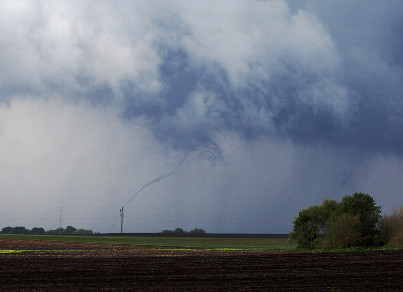
For
about 30 seconds, a very thin funnel becomes visible, likely touching
the ground several miles to the northeast, and therefore a tornado
again. It rarely appears as a complete funnel, but it was
close. Right after the shot above was taken, the funnel
disappeared completely.
I drove a couple of miles east to the
top of a rise and saw no more funnels, just a mean storm heading for
Danville, IL and then into Indiana. It destroyed a metal shed in
Tilton, IL, on the way, but there were no injuries. It also
damaged some homes in southwest Champaign, IL earlier on.
Please check back for future installements of "In
the Shop".
Mike
Lockwood
Lockwood Custom Optics